Hunter Geography Alumni Focus
An Interview with Ryan Edwards, BA, Geography, 2019
Edited by Christina Santiago, Hunter College, English major
|
|
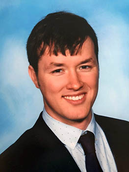
Ryan Edwards is currently working as a GIS specialist at Stellar Services. He graduated Hunter College in the Spring of 2019 with a bachelor’s degree in Geography. Edwards uses GIS in a range of projects throughout NYS and applies the knowledge, skills, and understanding of GIS practices to help solve every day problems, make lives easier, and makes our state more environmentally friendly.
Why study Geography?
I studied geography because I stumbled upon it. When I came to Hunter I (like most students) had no idea what I wanted to do, so I bounced around between science courses. These included Physics, Astronomy, Earth Science, Environmental Science, Computer Science, and then finally, Geographic Information Science. When I landed on GIS, the first day in the class I knew I had found what I was looking for. I instantly recognized the potential for GIS and its ability to shape, affect, and change the world we live in, but most of all, and what thrilled me about it, is it encompassed everything! Geography, and GIS, is a field where anything is possible. You can build programs to test the effects of physical processes on the world around us, you can plan cities, you can do intense data analytics on topics such as anthropology, earth science, history, sociology, and economics. It’s truly a tool of all trades and as someone who is constantly learning new things, it opened up the possibility of working in a field that doesn’t restrict me but instead gives me the tools to explore the world in a whole new way. So, geography ended up being perfect for me. Aside from the ability to delve into multiple programs a final driving factor became the marketplace and a need for GIS in the world around us. With a career in GIS I could not only sustain myself and my new born child but still make a difference (as all people want to do in their lives) on the world around me, by making others’ lives easier and simpler through the application of GIS.
Are you working on any current geography/GIS related projects?
I am currently working on two projects that deal with the Westchester county storm water system. In one of them I am mapping out the pipe network between catch basins so that the network can be back tracked if there is illicit discharge. Regardless of the purpose however, having such a network mapped is useful to many, as it also allows county officials to properly clean and maintain the system using a digital interface rather than paper maps. I am also mapping out the Outfalls for Westchester county, with a horizontal precision of <1ft. This is also useful as it allows county officials to properly inspect these outfalls in a timely manner, making the process of locating them significantly easier and less time consuming.
How has Hunter Geography helped shape who you are today/your future?
Hunter Geography taught me the tools I needed to succeed in the work world, teaching me the basis of GIS work and to think with a geographical mindset. I also met some amazing people along the way who I know will all succeed and change the world in their own respective fields.
What was being a student in NYC like?
New York City is one of the greatest places on earth, full of opportunity for those willing to grasp at it, however, having a fall back plan and support if it is ever needed is a must, as the city can consume you if you're not careful. As an undergraduate, who has and continues to live on Long Island, I love the city. However, it is ludicrously expensive to live here and would be wasteful to try to raise my son here as a single father, but I had the opportunity to reside with my parents on Long Island and save for the future.
Why is Geographic Approach important to your research?
The geographic approach is important to everything, as everything is located somewhere in space. Working at an IT company, we deal with data, and almost always, that data can, and should, have a spatial attribute to it, allowing it to be analyzed and categorized spatially so that our clients can put their data to use in the most efficient way possible. Empowering the Agencies and Companies of NY to think spatially enables them to save money, time, and resources when conducting business. In terms of NY agencies, this saves us; the tax payers, money, keeps our infrastructure better maintained and safer, and frees up time and resources to be allocated to new projects and change, making the lives of all New Yorker's better.
What does Geography mean to you?
Geography, to me, means allowing people to look at the world differently and enabling everyone to see a bigger picture when dealing with a complex problem. It also helps remind me that there is more to the world then my own little bubble.
What motivates your work?
As an applier, I take the knowledge and skills of a trade that not many people know about and use it to try to make the world a better place. That's what motivates me to do what I do, knowing that I am making a difference, however subtle it may be, to make the lives of those around me a little easier, while learning about all the intricacies of what keeps our world running in the process. Having mapped out a multitude of categories from railroad infrastructure, to college test scores, to storm water systems, I find that the more I map, the more I become interested in finding out how all of these intricate layers work together to sustain the lives we live today.
Published: July 18, 2019