
Hunter Geography Alumni Focus
Patricia Hackbarth (MA 2009)
|
|
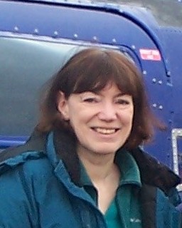
Pat Hackbarth prepares for a flight to view polar bears in the melting Arctic, October 2012. |
The first time I saw remote sensing images I fell hard for them. The colors, the shapes, the dynamic interplay of landforms – I suspected it would be an epic affair. I also suspected the technology would be another matter. I entered the Master's program barely able to put a paper together in Word. I had never used Excel, and had only the vaguest notion of what GIS was.
My background was in the arts, so it was really no surprise that the aspect of satellite imagery that first grabbed my interest was the aesthetic one. But as I made my way through the sequence of remote sensing classes, and learned about vegetation indexes and thermal plumes and drying wetlands – and discovered that all that technology was not the beast I thought it would be – another of my lifelong interests crept into the picture.
I have always been an avid reader, especially of literature with a strong reliance on landscape. As we studied various aspects of environmental change, I began to wonder what had become of some of the landscapes that had been central to some of those stories. Melting glaciers? I wondered if Hemingway's famed snows atop Kilimanjaro were still there. Drought in California? I tried to imagine what Steinbeck's Dust Bowl refugees would find in place of the once lush Central Valley. Drying wetlands and disappearing amphibians? Oh no, what about Mark Twain's Celebrated Jumping Frog?
Late one night in the geo lab, while I was supposed to be working on my thesis, I started rummaging around in the Landsat archives. They had just been made open to the public and free of charge, and I thought I was in Paradise. I began to collect examples of temporal change relating to various works of literature; I had to get a much bigger flash drive to accommodate all those big data files. I talked to writers about it, and they were enthusiastic.
The eventual outcome, many obstacles later (needless to say, I didn't know anything about writing html code either), was www.SceneChanges.org, which combines literary excerpts with satellite imagery and essays on what has happened to the landscapes at the center of the works. The environmental issues are as varied and complex as the literature itself, and my plan was to create a place where readers with an interest in the environment could go to learn more about the threats to some of the places they had developed a passion for, and find out how they could get involved in the effort to protect or restore them.
But literature was not at all the only field that could bring people to a greater interest in geography and environmental science, it turned out. Environmental studies programs are rapidly gaining in popularity on college campuses, cropping up where they never were before, recruiting students with an interest in the future of the planet. Administration officials are realizing that the next generation of graduates will need a far greater understanding of the challenges facing the Earth and its inhabitants than ever before.
These programs vary a great deal from one campus to another, but many include humanities courses with an environmental slant. And there is often an opportunity for geography to play a central role, tying the various courses together through their involvement with place. Quite often, there is also an opportunity for remote sensing to play a part in engaging students with the planet's concerns.
In the fine arts, for instance, students find inspiration on the USGS website called Earth as Art (http://eros.usgs.gov/imagegallery/earth-art), where satellite images from around the world have been selected for their extraordinary aesthetic qualities, with a brief description of what they show. It would be a hard task to study these images without taking an acute interest in the landforms and conditions they display.
History too is an especially strong example. So much of what has happened on the planet has been a result, directly or indirectly, of geography, and there seems to be a growing interest in exploring history from a geographical perspective. While satellite images don't go back to, say, 1492 – if only they did! – they can still be a valuable component in the study of past events. For example, the USGS offers another website called The Journey of Lewis and Clark (http://eros.usgs.gov/imagegallery/journey-lewis-and-clark), a collection of satellite images of places where the most important events of that journey took place, with descriptive information. This approach to history often appeals strongly to a student who doesn't enjoy reading a textbook.
In fact, one of the most valuable features of including geographical or environmental material in a class from another discipline is that it reaches the students who will never take a class in geography or environmental science, but who will need some knowledge of these issues as they and their peers tackle the world's challenges in coming years. It may be that required English class, or elective, that prepares them to handle that responsibility.
It's been exciting for me to work on this project and help provide an educational tool that can contribute to this rich and rewarding approach to education. I'm starting work on a new project now that will combine geography, literature, and American history by looking at journals of river trips, from Lewis and Clark to Aldo Leopold and John McPhee, including such writers as Thoreau, Twain, and John Wesley Powell. I remember reading, in the Geographic Thought and Theory class, of the dark days when so many illustrious universities decided geography was no longer relevant. They don't think that any more.
Published: August 12, 2013