
Hunter Geography Alumni Focus
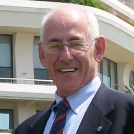
An Interview with Norman Cherkis, BA, Geology, 1962
|
Norman Cherkis graduated with a B.A. in Geology in 1962 and built a distinguished career in marine geology with the U.S. Naval Research Laboratory, mapping the seafloor worldwide and contributing to international oceanographic naming and mapping efforts.
I graduated from Hunter in June of 1962, with a BA in Geology at a time that the Department was called “Geology and Geography.” HD Thompson was the head of Geology and Rose Kiesler was the head of Geography. It was the “stone age,” before plate tectonics was accepted as fact rather than lunacy. Only Joe Rodriguez, a first-year instructor in the Department at the time, even mentioned it. Gordon Darkenwald was the overall chair of both the Bronx and Park Avenue departments. Finding a job in related field was nearly impossible. The only bite was the CIA, which was looking for aerial photo interpreters, shortly after the Cuban Missile Crisis. That job thankfully did not become a reality.
In 1963, I found a job with the US Naval Oceanographic Office in Suitland, Maryland, a suburb of Washington DC. I was assigned to a branch using sonar recordings to construct seafloor topographic maps. That involved going to sea aboard US Navy ships, collecting and putting the recorded depths on maps and making contour maps. That included a 9-day riverine mapping program in the Mekong Delta aboard a Hydrographic Service Vessel (the “Brown Water Navy”) in January 1966.
Navigation was still primitive, with star-fixes and Loran receptions being the primary source. Accuracy was plus or minus 4-5 nautical miles at best. By 1966, I had traveled all over the world collecting bathymetric soundings as they were called. However, since the Navy was offering advanced studies, I was assigned to a classified laboratory in Dobbs Ferry, New York, operated by Columbia University where I tested my bathymetric maps using submerged hydrophones being developed to hunt Soviet submarines. My studies provided an MA in Marine Geology as well as more time at sea testing the hydrophone acquisition capabilities. The Laboratory was forced to close in 1969 because of anti-Vietnam War demonstrations on the main Columbia campus.
I returned to Washington DC and this time was assigned to the Naval Research Laboratory where I work for the next 30 years, using upgraded technology and newer navigation systems to more accurately examine the seafloor, now using plate tectonics as a basis for interpreting the results and the oceanographic qualities of the water column above it, which led to developing an algorithm for better locating Soviet submarines. The algorithm worked so well that, beginning in late 1971, US antisubmarine warfare systems were able to locate and track Soviet submarines in the North Atlantic to within 20 miles until the end of the Cold War. In 1984 I was appointed to the Advisory Committee on Undersea Features (ACUF) of the US Board on Geographic Names, (including a 4-year stint as Chair) for 38 years—the longest anyone has served on any US government committee. I was also a member of the GEBCO (General Bathymetric Chart of the Oceans) subcommittees on Undersea Features Names and the Digital Bathymetry Subcommittee. And I was coauthor of the initial publication of the International Bathymetric Chart of the Arctic Oceans.
I authored or coauthored a number of peer-reviewed papers and bathymetric maps in the Arctic, Subarctic, North and South Atlantic Oceans as well as the Southern Ocean and south Indian Ocean. I also conducted aeromagnetic investigations over the Greenland Sea, western North Atlantic, Fiji plateau, “Roaring 40s and Howling 50s” south of Australia, and an area west of Diego Garcia in the Indian Ocean. I retired from the Naval Research Laboratory in 1969, worked as a contractor for another 9 years and finally, became a consultant to the Korean Hydrographic and Oceanographic Association in 2008, which was beginning to conduct studies in Korean territorial waters and helped create toponymy for newly discovered undersea features in the East Seas (Sea of Japan). I fully retired in 2018.
Overall, my career has put me in all 8 continents, all 5 oceans, 81 named seas and I have visited 54 countries outside the US. I have spent over 11 years on the high seas and I have 1649 hours in operational and research aircraft—all as a civilian (although I have visited ONE active war zone).
Published: October 20, 2025