Why use models?
Perhaps you're
wondering, "Why should I build a model when I can easily run the geoprocessing tools individually?" Running individual
tools is fine when your analysis doesn't involve much geoprocessing
or when you just need to produce data to support a one-time analysis.
If,
however, you have a complicated geoprocessing
workflow or you want to be able to easily repeat an analysis using different
data or parameters, a model is the way to go. Consider these advantages to
using models:
Models
provide a big-picture view of a project
Because of
their graphical nature, models are especially useful for visualizing a workflow
and the data that is being used and produced at each stage. They are also
useful for showing to others when explaining a complicated workflow. A workflow
presented in a model can be understood at a glance.
Models
are reusable
You can
save a model, open it, modify it, then run it over and over again—as many times
as you need to. This means that if you want to perform the same work more than
once, but with different parameters, you don't have to recreate it from
scratch; you can just modify one or more of the processes within the model. You
can easily experiment with different solutions to an analysis problem.
Processes
run seamlessly, faster
Processes
that are strung together in a model run seamlessly, one after the other, until
the workflow is completed. Running a model is considerably faster than running
each process separately from the tool dialogs.
Processes
can be run individually
A
complicated geoprocessing workflow is easier to
create by using a model, because you can build each process separately. When
creating a model that will run many interrelated processes, you can apply a
modular approach to your work—build the model piece by piece, testing each
process separately to make sure that it works as you want it to, before moving
on.
Models
make managing intermediate data easy
Because
each process creates output data that is used as input for another process, you
can end up storing many datasets you don't need. Sometimes, it can be difficult
to even identify intermediate datasets. With a model, deleting intermediate
data is easy. As you build a model, simply flag output data as intermediate,
then delete it with a single click after the model runs.
Models
can be shared
You can
share models with others to avoid duplication of effort and promote the
standardization of workflows.
![]() More about sharing models
More about sharing models
When sharing models, there are a couple of things to keep
in mind:
·
The
first is that in order for others to be able to use your models, you must save
all their component tools and data with relative path names. That way, when a
model is opened from a different location, it will be able to find the required
tools and input data and run properly. If absolute paths are saved with a
model, the model will look for its tools and inputs in the wrong locations—in
the folders on the model creator's computer or network where the tools and data
were stored when the model was created.
·
The
second thing to keep in mind is that in order for others to understand your
model and use it appropriately, you must document it. Just as you should
document your GIS datasets with metadata, you should document a model and its
processes. Because documentation is stored with a model, it is easily
accessible to those using the model.
Models can
have four different types of documentation:
·
Description
— you can document a model with a description that displays in the model
properties.
·
Metadata
— you can enter standard metadata, such as an abstract, statement of purpose,
and keywords, that will display in ArcCatalog
and in a Web browser.
·
Help
— with ModelBuilder's Documentation Editor, you can
create your own detailed model help, providing valuable information about the
model processes and the data produced by each. When you build a model, the name
of each tool you add is automatically listed in the model's help, which you can
then edit. You can view a model's help from ArcToolbox
or ArcCatalog.
·
Labels
— you can annotate model elements with graphic labels to help users more easily
interpret what's going on as they explore the model.
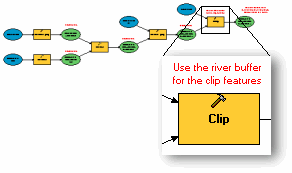
Labels help users understand a
specific aspect of a model or one of its elements.