Creating and using models
You've
seen how workflow diagrams can be used to plan the geoprocessing
operations used in a GIS analysis. When an analysis includes many geoprocessing operations, however, it can be difficult to
keep track of all the tool parameters and datasets that are being used and
created. ArcGIS provides a tool for automating your geoprocessing
work and performing GIS analysis more efficiently—the model.
A model is a collection of geoprocessing operations that automatically execute in sequence when the model is run to produce a final output dataset. Any geoprocessing operation in a model can be modified, then the model can be run again to quickly refine an analysis or produce new data that supports an alternative ("what if?") scenario.
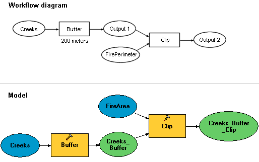
A workflow diagram can be turned into a model. Each geoprocessing tool in the model will automatically run in sequence to produce the final output data.
In ArcGIS, models are built and run in ModelBuilder™. In this topic, you will work with ModelBuilder to explore the advantages that models offer for GIS analysis.