Viewshed
The viewshed
identifies the cells in an input raster that can be seen from one or more
observation points or lines. Each cell in the output raster receives a value
that indicates how many observer points can see the location.
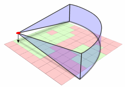
Viewshed analysis calculates
the area on a surface visible from one or more observation points. Parameters
typically can be set to control the vertical and horizontal field of view, the
height of the observer and target cells, and the view radius.
If you have only one
observer point, each cell that can be seen from the observer point is given a
value of 1. All cells that cannot be seen from the observer point are given a
value of 0.
The Observer Points feature
class can contain points or lines. The nodes and vertices of lines will be used
as observation points.