Merging rasters
Sometimes you want to
analyze an area that falls on more than one raster. To analyze the entire area,
you must perform the steps of your analysis multiple times, once for each
raster. Such a process could be time-consuming and error-prone, especially if
you have a large number of rasters or a multi-step
analysis. However, by first combining the individual rasters
to create a single larger raster, you'll only need to perform the analysis
steps once.
Rasters can be combined as
long as they share the same spatial reference and are of the same type, for
example vegetation.
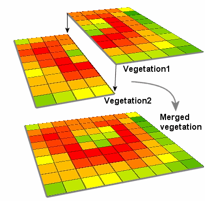
Perhaps you
want to analyze the variety of the vegetation in a particular agricultural or
wildlife management area using a vegetation raster. Your area of interest
happens to fall near the edge of the raster, so you need two different rasters to see the entire region.
There are a few things
you'll need to check before you combine rasters.
First, the input rasters may be totally overlapping, partially overlapping,
perfectly adjacent, or entirely separated, as long as they are in the same
coordinate system.
Second, the input rasters must be of the same type. For example, you could
combine a soils raster with one or more soils rasters
or an elevation raster with another elevation raster.
Third, you need to know if
you are combining discrete or continuous rasters
because the method used to join each type differs in how it handles areas where
the input rasters overlap.