Hillshade
Hillshading is a technique used to create a
realistic view of terrain by creating a three-dimensional surface from a
two-dimensional display of it. Hillshading creates a
hypothetical illumination of a surface by setting a position for a light source
and calculating an illumination value for each cell based on the cell's
relative orientation to the light, or based on the slope and aspect of the
cell.
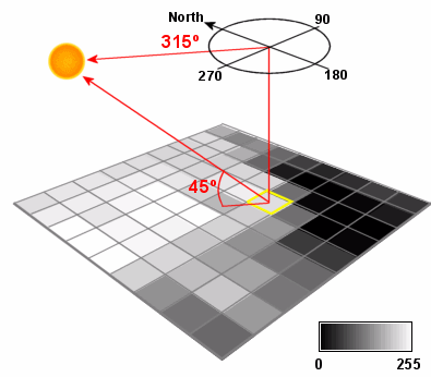
Hillshading computes surface
illumination as values from 0 to 255 based on a given compass direction to the
sun (azimuth) and a certain altitude above the horizon (altitude).
Hillshades are often used to produce maps that
are visually appealing. Used as a background, hillshades
provide a relief over which you can draw raster data or vector data.
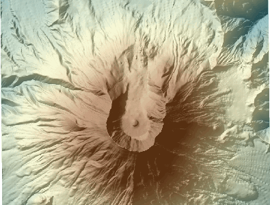
This map of
When
creating a cartographic hillshade, you should place
the light source in the north-west (upper-left) quadrant of the map to cast a
shadow at the bottom of the object (e.g., mountain). The eye tends to see
objects better when the shadow is cast at the bottom of them; placing the light
source elsewhere creates a visual effect that makes hills look like holes.
The values returned by hillshading may be considered a relative measure of
incident light. If you are locating a farm or solar panels, for example, you
may want to find well-illuminated slopes for them. Always use "real"
sun positions for analytic hillshades.