Viewshed
Viewshed identifies the areas of a surface
that can be seen from one or more observation points. The input is a raster or
TIN layer and the output is a new raster. Each cell in the viewshed
raster stores the number of observers who can see it.
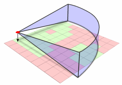
Green cells are visible from the red point,
pink cells are not..
The observation points can
be features in a point layer or feature vertices in a line layer.
Viewshed
parameters
Viewshed
analysis assumes that the observer’s field of view has no horizontal or
vertical constraints nor any distance limits.
You can control these
parameters and others by adding fields with specific names to the attribute
table of the observation layer. The field names and the effects they have are
summarized in the chart below.
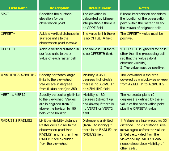
Viewshed analysis calculates
the area on a surface visible from one or more observation points. Parameters
typically can be set to control the vertical and horizontal field of view, the
height of the observer and target cells, and the view radius.