Surfaces and features
In 3D Analyst, you model reality
with surfaces and features.
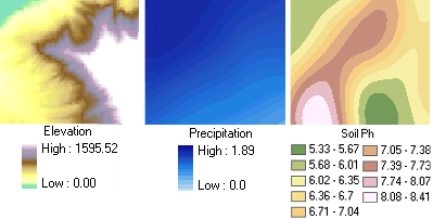
Surfaces model a phenomenon that
varies continuously across an area. Elevation, precipitation, and soil pH are
all phenomena suitable for modeling with surfaces.
|
|
|
Elevation, precipitation, and soil Ph are types of phenomena
that vary continuously across a landscape. With an infinite number of
possible values, these types of data are best represented with surfaces. |
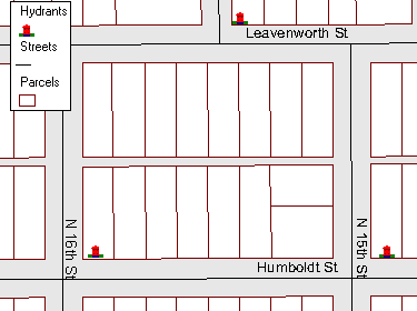
Features represent entities with
discrete boundaries. Buildings, wells, telephone poles, and roads are all
examples of data modeled as features. In each case, there is a clear boundary
or distinction between the features.
|
|
|
This map shows parcel, hydrant, and street features. There are a
limited number of possible features of each type, all of which have clear and
definable boundaries. |
![]() Distinguishing feature
from surface data
Distinguishing feature
from surface data
A clear
distinction occurs between feature and surface data if you consider the following:
·
Feature
data is countable. For example, you can count the number of parcels, streets,
or hydrants within a city.
·
Values
modeled with surfaces are not countable. If you think they are, try collecting
an elevation value for every square meter in your local park. Once you finish
the job, recollect the elevation values for every square centimeter. If you are
truly a masochist and complete this task too, reduce the sampling distribution
to every square millimeter and collect the values again. As you can see, this
madness could go on indefinitely leading to an infinite number of elevation
values, or at least until the you reached the
precision of your measuring instrument.
In 3D Analyst, surfaces are
represented by rasters or TINs.
Features are represented by 2D or 3D feature classes, such as shapefiles and geodatabases.