Surface
feature types
All you need to make a
Real terrain, however, often has
unique formations that are not well-modeled by mass point triangulation.
Ridges, cliffs, gullies, and man-made grades are a few examples. To capture
such formations, you can add line and polygon layers to the triangulation process.
For example, if your study
area includes a lake, you probably want the surface to be flat where the lake
is. You can add a lake polygon to the
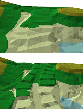
A mass point triangulation (top) does not adequately model
high-definition surface details, such as the graded building footprints of the
improved model (bottom).
You make these refinements
to the TIN structure by adding feature layers as particular surface feature
types. In the next concepts, you will learn more about them. The chart below
summarizes the surface feature types you can add to a TIN.
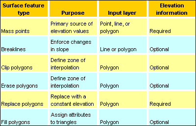
A summary of