Base heights
Base heights are the elevation
values that are used to display a layer in 3D. These values can come from
various places.
First, they can come from
information contained within the layer: the node elevations in a
Second, they can come from
information stored in a different
Third, elevation values can come
from a value or expression that you enter.
By default, 3D feature layers use
their z-values as base heights and TINs use their
node elevations. The default base heights for all other layers are 0.
|
|
|
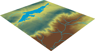
A raster elevation layer and 2D feature layers of a lake and
rivers. By default, these layers have their base heights set to 0, so they
display flat, like a sheet of paper. |
|
|
|
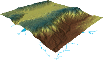
Here, the raster layer's base heights have been set to its cell
values, so it displays in 3D. Base heights have not yet been set for the
feature layers, so they lie underneath the raster. |
|
|
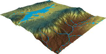
|
The raster layer has been used to set base heights for the
feature layers. The features now drape over the surface. |