Annotation feature classes
Annotation
feature classes are similar to other geodatabase
feature classes. Like other feature classes, annotation feature classes have
attributes (annotation attributes define how the text is to be displayed) and a
spatial reference, and they can be added as a layer to ArcMap.
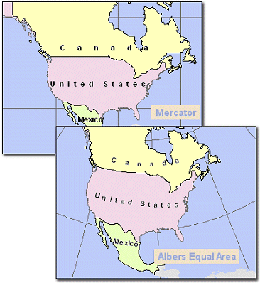
In this example, the annotation
feature class was created for a map in the Mercator
projected coordinate system. When the data frame's coordinate system is changed
to the Albers Equal Area projection, the annotation is reprojected
on the fly and displays correctly.
You can
create an annotation feature class in ArcMap by converting labels to
annotation. Or, you can create an empty annotation feature class in ArcCatalog, then add annotation
features to it in ArcMap. Once created, annotation feature classes are managed
the same way as other feature classes. They can be renamed, copied, and deleted
using ArcCatalog.
All
annotation feature classes have at least one annotation class. An annotation
class has a set of properties such as text symbology
and alignment. If you have an ArcEditor or ArcInfo license, you can create multiple annotation classes
within one annotation feature class and specify different annotation display
properties for different types of features.
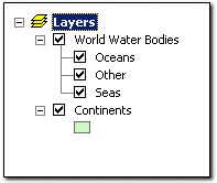
World Water Bodies is an annotation
feature class that has three annotation classes. In ArcMap, annotation classes
display in the Table of Contents. Each class can be turned on or off individually.