Editing coincident features
When
editing features, it's important to maintain the spatial relationships that
exist among them. For example, when you edit the shared boundary between two
land use features, you don't want to introduce a gap between the two. To prevent
editing errors, you can create a topology.
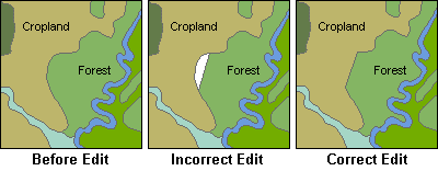
The spatial relationship between
two polygon features is distorted when edited incorrectly.
The primary
purpose of a topology is to define spatial relationships between features. The
primary spatial relationships that you can model using topology are adjacency,
coincidence, and connectivity.
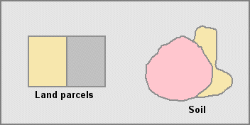
Adjacency allows you to identify
which land owners or soil types share a common boundary with each other.
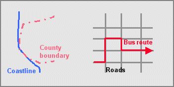
With coincidence, one boundary can
lie on top of another. You can identify the bus routes on top of roads
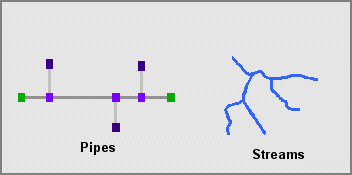
Connectivity allows you to follow a
path from the water treatment plant to a house or the flow of water through
streams.
As you
learned a few weeks ago, there are three types of topology available in a geodatabase: map topology, geodatabase
topology, and topology in a geometric network.
The three
types of topology are all similar in that the spatial relationships are based
on coincident geometry. They differ in how they are created and maintained.