Evaluating
your data
You may
already have data in various formats that you want to migrate to a geodatabase. Before you create a geodatabase
and set up its structure (schema), you'll want to review the data you plan to
add. Below are some of the questions you should consider.
· Is the data in a format that can be
migrated to the geodatabase?
The following vector data formats are supported by all
personal and enterprise geodatabases:
· CAD
· Coverage
· dBASE
·
· Shapefile
If you're using an ArcInfo or ArcEditor license, you can also import other ESRI data
formats, including ArcSDE layers, ArcStorm,
and ArcInfo LIBRARIAN data.
· How will different types of
features in the source data be supported by the geodatabase?
Spatial data may be mapped to a different feature type in
the geodatabase. For example, all feature types in a coverage can be imported into a geodatabase,
but multiple coverage feature types may be mapped to a single feature type in
the geodatabase. For example, point, tic, and node
feature classes will all map to a point feature class in a geodatabase.
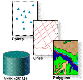
The feature geometry types supported by the geodatabase are point (and multipoint), line, and polygon.
In addition to x,y
coordinates, the geodatabase can store z and m
(measure) values for each vertex that comprises a feature. Line and polygon
features with parametric curves are also supported.
When you import spatial data into a
geodatabase, feature geometry will be mapped as
points, lines, or polygons.
![]() More about z and m values
More about z and m values
Z values are normally used to store values such as
elevation or rainfall for a vertex. Z values are set by importing or loading a
3D shapefile or by draping a feature class over a
surface.
M values are normally used to store a linear measure from
a defined origin for a vertex in a line. They are used by the linear
referencing tools available in ArcMap to locate
events along a line, such as a car accident that occurred at mile 10.64 on the
freeway. M values are set by importing or loading a coverage route system or by
using the ArcMap linear referencing tools.
Both z and m values may be positive or negative and stored
in any appropriate units.
· What field types are supported in geodatabase tables?
As with your feature data, you want to be aware of how
your attribute data will be mapped to the field types supported in the geodatabase. The table below compares some common geodatabase,
|
Geodatabase |
|
dBASE |
|
Short
integer |
2-byte
binary |
Number
or Boolean |
|
Long
integer |
4-byte
binary |
Number |
|
Float |
4-byte
floating point |
Float or
number |
|
Double |
8-byte
floating point |
Float or
number |
|
Text |
Character |
String |
|
Date |
Date |
Date |
![]() More about geodatabase
field types
More about geodatabase
field types
The geodatabase supports the
following field types for user-defined attributes in feature class tables and nonspatial tables.
|
Name |
|
Size |
Applications |
|
Short
integer |
-32,768
to 32,767 |
2 |
Numbers
without fractions within specific range; coded values |
|
Long
integer |
-2,147,483,648
to 2,147,483,647 |
4 |
Numbers
without fractions within specific range |
|
Single-precision
floating point number (Float) |
Approx.
-3.4E38 to 1.2E38 |
4 |
Numbers
with fractions within specific range |
|
Double-precision
floating point number (Double) |
Approx.
-2.2E308 to 1.8E308 |
8 |
Numbers
with fractions within specific range |
|
Text |
Up to
64,000 characters |
Varies |
Names or
other textual qualities |
|
Date |
mm/dd/yyyy |
8 |
Date
and/or time |
|
BLOB |
Varies |
Varies |
Images
or other multimedia |
|
Raster |
Varies |
Varies |
Images
or pictures |
|
GUID |
36
characters enclosed in curly brackets |
16 or 38 |
Customized
applications requiring global identifiers |
Other
important considerations for data migration include the coordinate system, resolution,
and quality of the data (which should be documented in the datasets' metadata).