Relationship
classes
In a geodatabase, relationship classes provide a way to model
relationships that exist between real-world objects such as parcels and
buildings or streams and water sample data. Relationship classes help make your
For
example, in the real world, buildings are always located on parcels. When the
ownership of a parcel changes hands, the ownership of the buildings on the
parcel usually changes as well. If a building footprint changes, it can affect
the parcel (the value of the parcel improvements may increase or decrease). By
setting up a relationship class between these two feature classes, you can help
make sure that when a feature in one of the feature classes changes, related
features in the other feature class are updated.
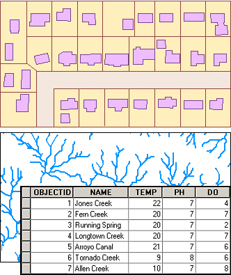
The relationships stored in a
relationship class can be between two feature classes (such as buildings and
parcels, top) or between a feature class and a nonspatial
table (such as streams and water quality sampling data, bottom).
When you
create a relationship class, you define the properties of the relationships.
Recall in the first exercise of this module, when you deleted some lots from
the subdivision, the homes located on the lots were also deleted automatically.
This behavior between the related objects was controlled by a relationship
property.
You can
also create rules to maintain valid relationships. For example, you could set
up rules that control how many buildings are allowed on parcels in different
zoning areas.
Relationship
classes are created in ArcCatalog. You will work with
relationship classes in Lab 9.