Planar coordinate systems
There's
supposed to be a big yard sale at
Suppose,
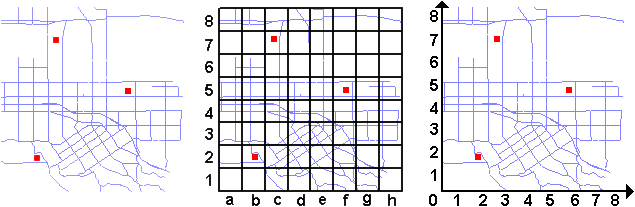
instead, you take a ruler and pencil, divide the map into squares, and label
each square. Then you could write down the names of all the streets in each
square and alphabetize your list. To find the intersection of Center and Palm,
you would look up
Note that
it doesn't matter what projection the map is in, what
its scale is, or what part of the earth it covers. A locational reference
system can be applied to any map because the grid of squares has nothing to do
with the specific properties of the map. It's just a way to pigeonhole
locations to make them easier to find. (The size of the squares is up to you.
For that matter, you could use something other than squares, if you really
wanted to.)
Is this a
coordinate system? It's debatable. Suppose your grid has 36 squares and you
label each square with a number from 1 to 36. Where exactly are the
coordinates? But suppose instead you number both rows and columns from 1 to 6.
In this case, each square is defined in terms of a pair of numbers, like (3, 4)
or (6, 1) and it sounds like you do have coordinates, even if they're not very
precise.
Planar
coordinate systems, however, are usually understood to be systems that assign
location references to individual points, not just to areas, and that support
analytic geometry (which means you can use them to calculate distances and
directions between points). These systems are based on Cartesian coordinates,
invented by the French mathematician and philosopher Rene Descartes. You'll
look at these systems next.
Left: