Geographic coordinate systems
A geographic
coordinate system (
The
latitude-longitude system
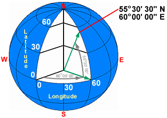
The main geographic coordinate system is the
latitude-longitude system, which you already know about. Lines of latitude are
parallel circles that run east–west around the globe, getting smaller as they
approach the poles. Their values range from +90° (north pole)
to -90° (south pole), with the equator being 0°. Lines of longitude are
half-circles that run north–south from pole to pole. Their values range from 0°
to 360°, with 0° being arbitrary, but commonly designated as the line that
passes through
The network
of intersecting lines is called a graticule.
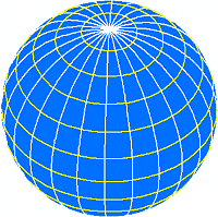
Lines of latitude and
longitude form a mesh called a graticule. Latitude
lines (parallels) are shown in yellow. Longitude lines (meridians) are white.
Defining
latitude and longitude
When the earth is treated as a sphere, latitude is the
angle between two lines drawn to the center of the earth: one from a point on
the equator and the other from a specified point on the same meridian.
Longitude
is an angle between two lines drawn to the center of the earth from the
equator: one at the prime meridian and the other at a specified meridian.
Latitude and longitude
defined on a sphere.
When the
earth is treated as a spheroid, latitude is the angle between two lines drawn
toward the center of the earth: one from a point on the equator and the other
normal (perpendicular) from a plane that touches the spheroid at a specified
point.
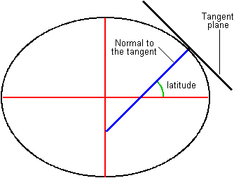
Latitude defined on a
spheroid. The lines don't intersect at the center of the earth (unless the
plane is tangent at a pole).
Longitude
is defined on a spheroid the same as it is on a sphere.