Classifying data
You have now learned that you can symbolize feature
quantities by placing features into groups, or classes, based on similar
attribute values. But what process is used to create the classes? What
determines whether a particular attribute value falls into one class or
another?
When
symbolizing features based on quantities in ArcMap, three things must be
decided:
· How many classes to have
· What method to use for placing the
values into classes
· What kind of symbology to use
(e.g., graduated colors or graduated symbols)
There are several different methods available in ArcGIS that you can use to classify features. This topic describes the most common ones and discusses when and how to use them.
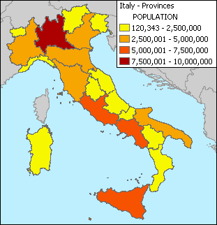
This graduated color map was created by classifying population values into four classes.