Symbolizing features based on attributes
So far, you have seen how to symbolize all of a layer's features with the same symbol, which distinguishes features in different layers.
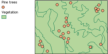
In this map, all the pine trees have the same symbol, as do the vegetation polygons. You can easily see that pine trees tend to occur in clusters
Features can also be symbolized based on an attribute. A map on which features have been symbolized based on an attribute is called a thematic map, and thematic maps often communicate more information. For instance, on the map shown above, vegetation polygons could be symbolized by a type attribute to indicate different areas such as forest, grassland, or marsh. Individual tree locations could be symbolized by a diameter attribute to show the distribution of trees by size.
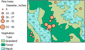
In this version of the map, the pine trees have been symbolized based on their diameter and the vegetation polygons have been symbolized based on their type. Now you can see that the largest trees occur in just one cluster. You can also see that pine trees are not found in marsh areas.
The type of symbology you use to create a thematic map depends on whether an attribute's values are categories (e.g., type) or quantities (e.g., diameter). In this topic, you'll learn more about symbolizing features based on attribute values.