Metadata
Metadata
is commonly called "data about data." More precisely, metadata is
information that describes, or documents, a geographic dataset.
In the
real world, examples of unofficial metadata can be found almost everywhere (the
handwriting on the back of a photograph is one example). The type of metadata
used to describe data used in a
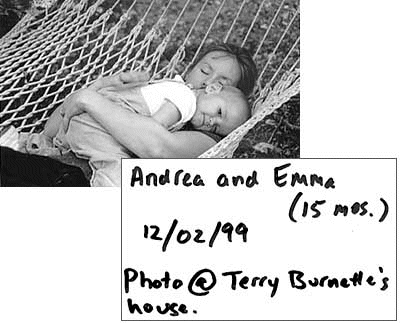
The writing on the back of a photograph is an unofficial metadata record that describes the contents and context of the photo.
A metadata
record for a
You
create, edit, and view metadata in ArcCatalog. ArcCatalog automatically derives and documents some data
properties, such as the geographic extent. Other properties, such as when and
how the data was collected, must be documented by the data creator.
ArcCatalog provides different stylesheets for viewing metadata. The FGDC ESRI stylesheet consists of three tabs: Description, Spatial, and Attributes. Mouse over the bullets below to see an example of each tab.
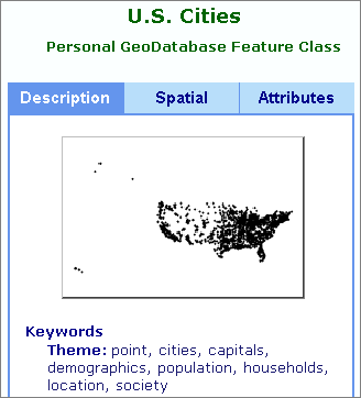
The Description tab displays a thumbnail graphic of the data as well as keywords, an abstract, and a purpose statement (not shown here). Publication information is also included in the Description tab.
Members of
the