ArcCatalog
ArcCatalog
is the ArcGIS application designed for browsing, managing, and documenting
geographic data. Think of ArcCatalog as a window into
your
To access
data, you create a connection to its location (such as a folder on your C:
drive). Collectively, the connections you create are called the Catalog.
The ArcCatalog interface consists of the Catalog tree on the left and a preview pane on the right. You use the Catalog tree to navigate and browse data.
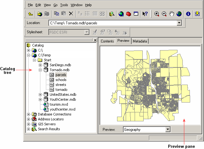
The Catalog tree shows the folders and files that you're connected to; you can view their contents in the preview pane.
In the
preview pane, you can view the contents of a folder and the geography (feature
shapes) and attributes stored with individual datasets. The preview pane is
also where you view metadata, an important component of data used in a
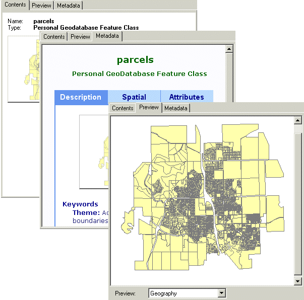
The preview pane has three tabs which provide different views of your data. The Contents tab shows a list or thumbnail graphics of folders and files. The Metadata tab shows information that has been documented for a dataset. The Preview tab shows the geographic and tabular information for a dataset.
ArcCatalog and ArcMap work together. You can find and preview data in ArcCatalog, then drag and drop the data into ArcMap to work with it.